Last official estimated population of Riverside County was 2,202,553 (year 2014)[1]. This was 0.691% of total US population and 5.6% of total California state population. Area of Riverside County is 7,303.3 mi² (=18915.4 km²), in this year population density was 301.58 p/mi². If population growth rate would be same as in period 2010-2014 (+0.15%/yr), Riverside County population in 2026 would be 2,241,748 [0].
Historical population of Riverside County for period 1900-2014 [1] , [2] , [3]:
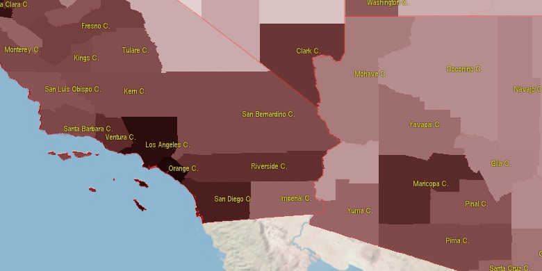
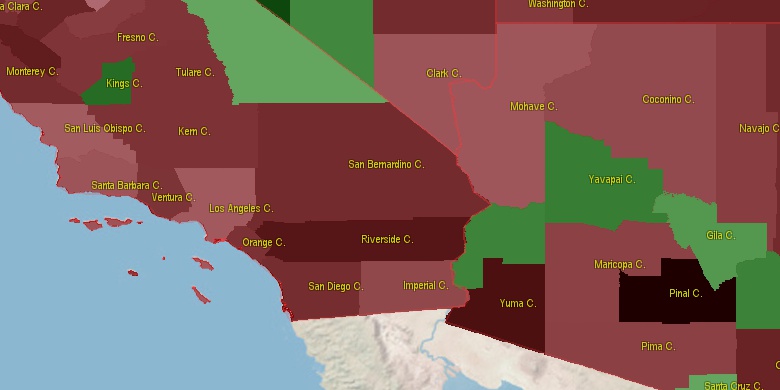
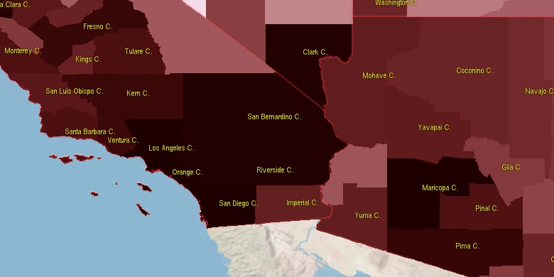
Estimated population for 2014[1]. Population density is in p./sq.mi [4]. Changes are for period 2010-2015. Value is %/year. Boundary lines are approx. 2012 [5]. Click on flag to hide it.
Population • Density • Changes • Legends • Position

[1900-1910] +6.84 %/yr
[1910-1920] +3.78 %/yr
[1920-1930] +4.88 %/yr
[1930-1940] +2.68 %/yr
[1940-1950] +4.89 %/yr
[1950-1960] +6.06 %/yr
[1960-1970] +4.13 %/yr
[1970-1980] +3.75 %/yr
[1980-1990] +5.85 %/yr
[1990-2000] +2.82 %/yr
[2000-2005] +4.57 %/yr
[2005-2010] +2.54 %/yr
[2010-2014] +0.15 %/yr
Looking for settlements in Riverside County? Visit this page: Settlements in Riverside County, CA
Population of Riverside County by age groups male (M) and female (F)[1b]
| Age Gr. | (M) | (F) | Total |
| 0 to 4 | 80633 | 77133 | 157,766 |
| 5 to 9 | 87573 | 84105 | 171,678 |
| 10 to 14 | 88995 | 86285 | 175,280 |
| 15 to 19 | 90989 | 87552 | 178,541 |
| 20 to 24 | 88872 | 84619 | 173,491 |
| 25 to 29 | 81627 | 77478 | 159,105 |
| 30 to 34 | 78177 | 77431 | 155,608 |
| 35 to 39 | 72623 | 74434 | 147,057 |
| 40 to 44 | 74688 | 76247 | 150,935 |
| 45 to 49 | 75929 | 74569 | 150,498 |
| 50 to 54 | 76691 | 76017 | 152,708 |
| 55 to 59 | 67955 | 68886 | 136,841 |
| 60 to 64 | 53905 | 58587 | 112,492 |
| 65 to 69 | 46640 | 51806 | 98,446 |
| 70 to 74 | 34754 | 40466 | 75,220 |
| 75 to 79 | 25618 | 30114 | 55,732 |
| 80 to 84 | 17898 | 21858 | 39,756 |
| 85+ | 14839 | 23278 | 38,117 |
Riverside County resident population estimates by Sex, Race, and Hispanic Origin[1b]. For full list of abbrevations see: population.us/about page.
| Race | Male | Female | Total |
| WAC | 971071 | 973370 | 1,944,441 |
| WA | 936265 | 938188 | 1,874,453 |
| NH | 604351 | 619950 | 1,224,301 |
| H | 554055 | 550915 | 1,104,970 |
| HWAC | 516621 | 512271 | 1,028,892 |
| HWA | 504463 | 499913 | 1,004,376 |
| NHWAC | 454450 | 461099 | 915,549 |
| NHWA | 431802 | 438275 | 870,077 |
| AAC | 91492 | 101520 | 193,012 |
| BAC | 95779 | 96097 | 191,876 |
| NHAAC | 80372 | 89976 | 170,348 |
| BA | 81865 | 81709 | 163,574 |
| NHBAC | 80181 | 79376 | 159,557 |
| AA | 74171 | 84354 | 158,525 |
| NHAA | 67308 | 77192 | 144,500 |
| NHBA | 70651 | 69530 | 140,181 |
| TOM | 39136 | 39676 | 78,812 |
| IAC | 33809 | 34304 | 68,113 |
| NHTOM | 25735 | 26008 | 51,743 |
| HIAC | 22620 | 22477 | 45,097 |
| IA | 21890 | 21929 | 43,819 |
| HIA | 16381 | 16186 | 32,567 |
| HBAC | 15598 | 16721 | 32,319 |
| HTOM | 13401 | 13668 | 27,069 |
| HBA | 11214 | 12179 | 23,393 |
| NHIAC | 11189 | 11827 | 23,016 |
| HAAC | 11120 | 11544 | 22,664 |
| NAC | 8912 | 8909 | 17,821 |
| HAA | 6863 | 7162 | 14,025 |
| NHNAC | 6001 | 5906 | 11,907 |
| NHIA | 5509 | 5743 | 11,252 |
| NA | 5079 | 5009 | 10,088 |
| NHNA | 3346 | 3202 | 6,548 |
| HNAC | 2911 | 3003 | 5,914 |
| HNA | 1733 | 1807 | 3,540 |
• Los Angeles County population
133.4 mi,  283°
283°
• San Diego County
66.1 mi,  222°
222°
• Orange County
102.1 mi,  267°
267°
• San Bernardino County
78.6 mi,  352°
352°
• Clark County
180.5 mi,  18°
18°
• Ventura County
184.4 mi, 283°
• Mohave County
187.7 mi,  42°
42°
• Yuma County
137.7 mi,  118°
118°
• Imperial County
60.5 mi,  141°
141°
• La Paz County
112.8 mi,  90°
90°
[0] Calculated by population.us from last known population growth rate, not official data.
[1] County population - 2014, archived from the original, retrieved 02/23/2016
[1b] Annual County Resident Population Estimates by Age, Sex, Race, and Hispanic Origin, (used only data for 2014) archived from the original, retrieved 02/23/2016
[2] County population - 2000-2010, archived from the original, retrieved 02/23/2016
[3] Population of States and Counties of the United States: 1790 to 1992, PDF, 15 Mb, census.gov, retrieved 02/23/2016
[4] County area, latitude longitude data, retrieved 02/23/2016
[5] County boundaries, CSV files on boundaries.us, retrived 03/18/2016
*San Diego, San Bernardino California Notes
Page generated in 0.001 seconds© 2016 population.us | Terms of use | Contact